

Mobility is much more than just the movement of people and goods. It is a fundamental element of quality of life, economic activity, access to services and territorial cohesion. However, each region faces very different realities, which means that mobility solutions cannot be addressed using standardised approaches or one-size-fits-all models.
Mobility planning, transport engineering and traffic studies require an understanding of how each environment functions, what its specific needs are and what factors influence travel patterns. The challenges facing a mountain town under heavy tourist pressure are not the same as those of a historic city, a logistics hub, a mass-attendance event or a town centre with intense commercial activity.
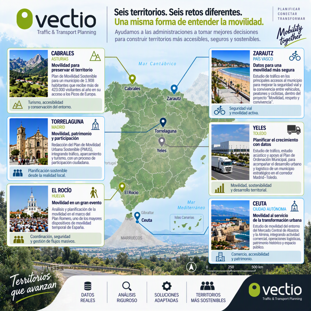
Over recent years, Vectio has worked on projects across Spain that reflect this diversity. Cabrales, Zarautz, Torrelaguna, Yeles, El Rocío and Ceuta represent six completely different scenarios, yet they share a common goal: to use data and technical analysis to improve mobility and help build more accessible, safer and more sustainable regions.
Cabrales: sustainable mobility to preserve a unique environment
Mobility in rural and mountainous areas has characteristics that are very different from those in urban areas. The municipality of Cabrales, with just 1,884 registered residents, receives more than 420,000 visitors annually, which translates to a ratio of 225 tourists for every resident. Its location near the Cantabrian coast of Asturias and as the gateway to the Picos de Europa makes it a perfect example of an area with high tourist demand, especially during the summer months.
The daily lives of the local population coexist with the arrival of numerous visitors drawn by the area’s natural resources. This combination generates highly variable demand for mobility throughout the year, with periods of high intensity at certain access points and in areas of great environmental value.
In this context, mobility planning must strike a balance between accessibility and conservation. It is not merely a question of facilitating travel, but also of protecting the environment, minimising impacts and ensuring that tourism development is compatible with the sustainability of the area.
Analysing mobility patterns helps to identify how journeys are made, where the greatest pressures are concentrated, and what measures can help to improve the experience for both residents and visitors. The management of access routes, parking, pedestrian movement and sustainable mobility form part of a comprehensive approach that helps to preserve one of Spain’s most valuable natural environments.
 The village of Bulnes, in the heart of the Picos de Europa, is part of the municipality of Cabrales
Zarautz: data and road safety for safer mobility
Coastal towns and municipalities face particularly complex mobility dynamics due to the coexistence of residents, visitors and different modes of transport.
In the town of Zarautz in Gipuzkoa (population 23,496), road safety and the coexistence of vehicles, pedestrians and cyclists are key elements in urban mobility management. The high volume of pedestrian traffic and significant cycling activity necessitate a precise understanding of how the town’s access routes and main corridors function.
Traffic data plays a fundamental role here. Through technical analysis, it is possible to determine traffic volumes, identify potentially conflict-prone situations and assess the need for improvements from an objective perspective.
Active mobility plays a leading role in this type of environment. Walking and cycling are part of everyday life and help to create more sustainable, healthy and safe urban spaces. Therefore, any mobility strategy must pay particular attention to the interaction between the various users of public space.
The experience in Zarautz demonstrates how traffic studies can become essential tools for improving road safety, fostering harmonious coexistence and moving towards more balanced mobility models.

The coastline of Zarautz (Guipúzcoa) is one of the most popular tourist destinations in the Basque Country. Photo @Lukas Budimaier
Torrelaguna: planning mobility based on local realities
Mobility planning takes on a special dimension when carried out in towns with a significant historical heritage and a strong local identity.
In Torrelaguna (Madrid), the development of a Sustainable Urban Mobility Plan (SUMP) made it possible to analyse, in a comprehensive manner, aspects as diverse as traffic, parking, accessibility, tourism and the organisation of public space.
SUMPs have established themselves as one of the main tools for guiding municipal mobility policies. Their holistic approach makes it possible to move beyond isolated solutions and tackle challenges from a long-term strategic perspective.
In historic towns, moreover, it is essential to reconcile urban functionality with heritage conservation. Streets, squares and public spaces fulfil functions that go far beyond mere circulation, acting as meeting places and elements that form part of the area’s identity.
Another particularly important aspect is public participation. Mobility directly affects people’s daily lives, so incorporating their perspectives and experiences enriches the technical analysis and improves the formulation of proposals.
The experience in Torrelaguna (5,081 residents, according to the latest census) demonstrates that well-planned mobility must always be based on a thorough understanding of local conditions.
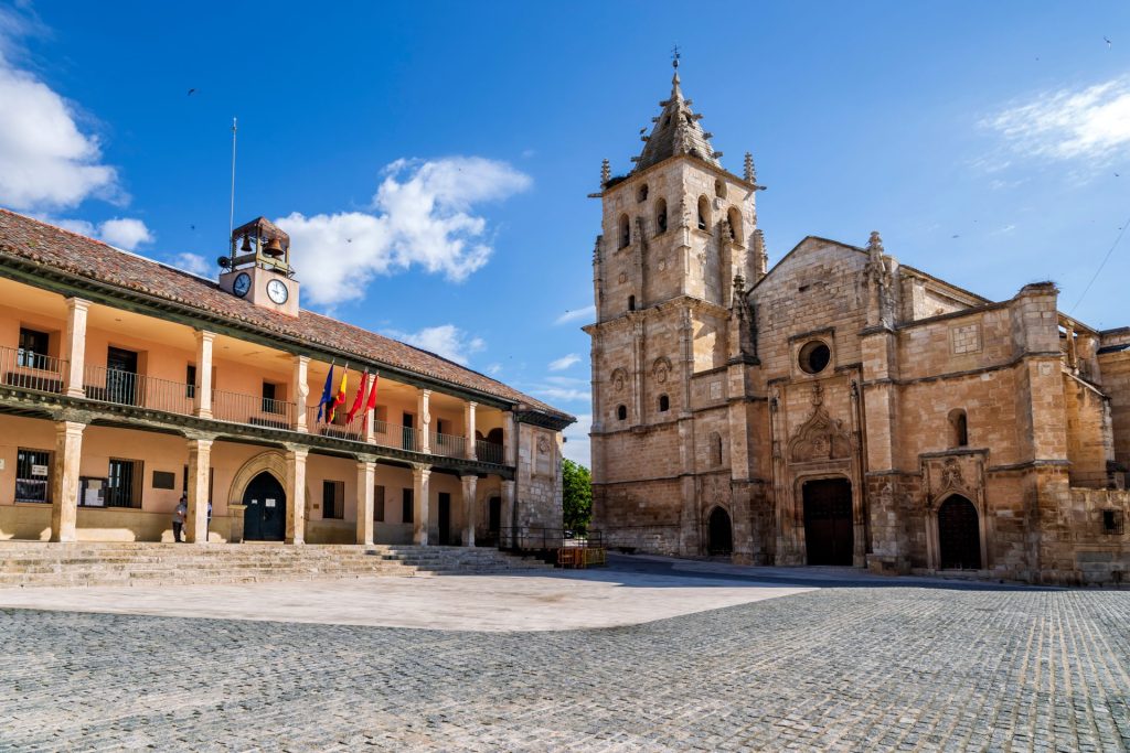
Torrelaguna is one of the most picturesque towns in the Sierra Norte region of the Community of Madrid
Yeles: mobility and planning to support urban growth
Urban growth and the development of new economic activities pose significant challenges for mobility and spatial planning. The town of Yeles, in the province of Toledo, is a clear example of how, over the last quarter-century, some areas near Madrid have experienced a population boom. In 2000, it had only 1,731 residents, and according to the latest census figures, that number has quadrupled to the current 6,514.
Yeles serves as an example of how traffic studies can help anticipate future needs and facilitate balanced growth. Its location within a strategic corridor makes mobility a key factor in ensuring both accessibility and the smooth running of productive activities.
The presence of industrial and logistics uses introduces specific variables relating to freight traffic, heavy goods vehicles and access to areas of economic activity. These dynamics must be analysed in conjunction with urban mobility to ensure proper integration between the two spheres.
Data-driven planning enables the evaluation of different scenarios, the identification of potential impacts and the proposal of measures that promote the harmonious coexistence of the municipality’s residential, productive and logistics functions.
This type of work demonstrates the importance of incorporating mobility criteria from the initial stages of spatial planning. Anticipating problems is always more effective than trying to correct them once they have become entrenched.
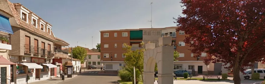
Yeles is located along the logistics and commercial corridor connecting Madrid and Toledo. www.turismocastillalamancha.es
El Rocío: managing mobility during major events
The transport needs associated with major temporary events represent one of the greatest challenges for transport engineering. One of the most striking examples in the whole of Spain is the town of El Rocío, in Huelva. With a population of just 1,537, it welcomes almost a million people during its famous pilgrimage.
El Rocío is a prime example of this reality. During certain periods, the area must accommodate an extraordinary volume of journeys concentrated within a limited timeframe, resulting in a complex logistical and traffic management operation.
Mobility planning in such scenarios requires a comprehensive approach that takes into account access routes, car parks, vehicle traffic, pedestrian movements and operational coordination. All these elements must work in a coordinated manner to ensure safety and the smooth running of the event.
Unlike everyday mobility, large temporary gatherings require measures to be continually adapted to the actual conditions at any given moment. Monitoring traffic flows and the ability to respond swiftly become decisive factors in the success of the operation.
The experience gained from this type of initiative demonstrates that mobility is a key tool for managing major events safely, efficiently and sustainably.
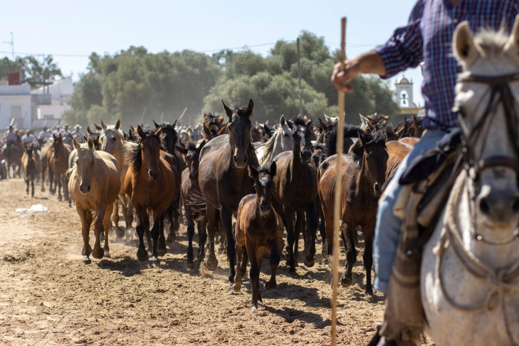
The Rocío pilgrimage in Huelva is one of the most well-attended in Spain
Ceuta: urban mobility to drive the city’s transformation
Mobility also plays a fundamental role in urban regeneration and the revitalisation of commercial and heritage areas.
In Ceuta, whose population now exceeds 83,000, an analysis of mobility in an area of high economic and social activity made it possible to address the relationship between accessibility, urban logistics, commercial activity and the quality of public space.
Urban centres bring together multiple functions that must coexist in a balanced manner. Shopkeepers, residents, visitors, loading and unloading operations, and everyday journeys all share limited spaces that require proper organisation.
Improving urban mobility is not merely about facilitating traffic flow. It also involves creating spaces that are more accessible, comfortable and attractive for those who live, work or carry out activities there. In this sense, mobility and urban transformation form part of the same strategy aimed at enhancing urban quality and boosting economic activity.
The case of Ceuta illustrates how technical analysis can become a tool to support urban improvement processes and generate benefits for the city as a whole.
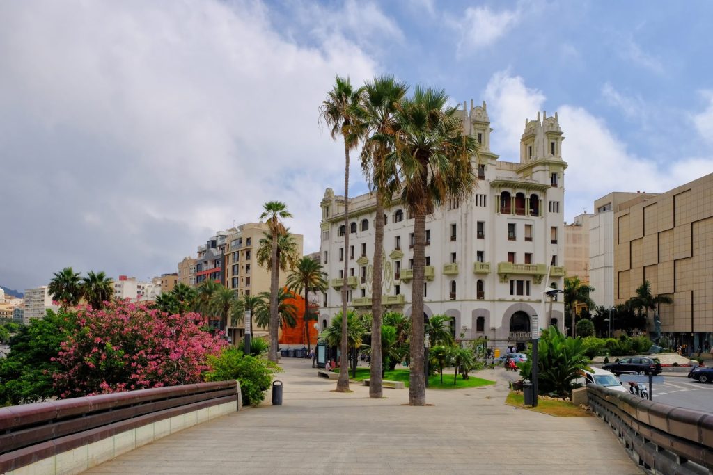
The Autonomous City of Ceuta preserves architectural features from centuries past
A single methodology for completely different areas
Although the projects carried out in Cabrales, Zarautz, Torrelaguna, Yeles, El Rocío and Ceuta address very different needs, they all share a common methodology based on four fundamental principles.
Firstly, the collection of real-world data that provides an objective understanding of how mobility functions. Secondly, a rigorous technical analysis of this data to understand the causes and consequences of the various phenomena observed.
The third element involves tailoring solutions to the specific characteristics of each area. No two local authorities are the same, nor are any two projects identical; therefore, planning must always respond to the particularities of the local context.
Finally, it is essential to gear each proposal towards generating value for the area, by improving accessibility, road safety, sustainability and people’s quality of life.
Mobility as a tool for generating territorial value
Mobility should not be understood solely as a matter of infrastructure or transport. It is a strategic tool capable of driving economic development, improving accessibility, strengthening the competitiveness of territories and promoting a more efficient use of public space.
Proper planning helps to reduce conflicts, optimise resources, facilitate economic activity and improve the experience of those who use streets, roads and urban spaces on a daily basis.
Therefore, every mobility study represents an opportunity to gain a better understanding of the region and to guide its future development in a more sustainable and balanced way.
Vectio: tailored solutions for every region
The projects carried out in Cabrales, Zarautz, Torrelaguna, Yeles, El Rocío and Ceuta demonstrate that each area presents unique challenges and requires specific solutions. These challenges may relate to tourism, road safety, active mobility, logistics, major events, urban accessibility or the transformation of commercial spaces, but they all share a common need: to understand how the area functions before taking action.
At Vectio, we draw on transport engineering, mobility planning, traffic studies and territorial analysis to transform data into knowledge and knowledge into decisions. Our experience in rural municipalities, urban environments, historic towns, logistics areas and major events enables us to adapt to very different realities without losing sight of the ultimate goal: to generate value for people and for local areas.
Because every place is different, but all can move forward when they have solutions tailored to their real needs. At Vectio, we specialise in adapting to all kinds of projects and in turning mobility into a tool that serves development, sustainability and the improvement of the local area.
About Vectio
At Vectio, we focus on effective planning for sustainable mobility; we are experts in this field. Throughout our nineteen years in business, we have always maintained a commitment to innovation, relying on the technologies most in demand by our clients. We firmly believe that, after successfully completing more than 1,500 projects, what sets us apart from any other company in the industry is our use of the best technology for collecting and analyzing traffic and mobility data.